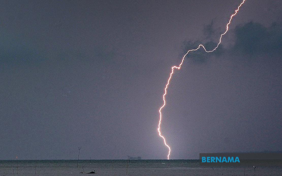
Malaysia's Meteorological Department has issued a weather alert for thunderstorms, heavy rainfall and strong winds affecting numerous districts across seven states and the federal territory of Labuan, with conditions expected to persist through the afternoon until 5 pm. The advisory comes as the region enters a period of heightened atmospheric instability, with MetMalaysia monitoring weather systems that could bring disruption to travel, outdoor activities and daily operations across multiple areas of the country.
In northern Peninsular Malaysia, the Kedah district of Baling faces the brunt of the expected adverse weather. Across the Perak region, nine districts have been placed under alert: Manjung, Kinta, Perak Tengah, Kampar, Bagan Datuk, Hilir Perak, Batang Padang and Muallim, indicating that the entire western seaboard and central portions of the state are susceptible to severe weather development. This concentration of affected areas in Perak suggests meteorological conditions are particularly unstable across the state's diverse topography, from coastal plains to inland highlands.
On the east coast, Terengganu's vulnerability spans seven districts from its northern reaches to its southern boundaries. Setiu, Kuala Nerus, Hulu Terengganu, Kuala Terengganu, Marang, Dungun and Kemaman are all anticipated to experience the same weather pattern, reflecting how summer monsoon influence can create widespread instability across the entire state. This broad geographic exposure underscores the scale of the weather system affecting the region.
Pahang, despite its large size, has four districts on high alert: Tanah Tinggi Cameron, Lipis, Jerantut and Kuantan. The inclusion of highland areas such as Tanah Tinggi Cameron suggests that elevated terrain will experience particularly intense precipitation, as wind patterns force moisture-laden air masses upward. Kuantan, the state capital on the coast, indicates that lowland areas are equally vulnerable to the system's effects.
In Selangor, the alert extends across four districts: Sabak Bernam, Kuala Selangor, Hulu Selangor and Gombak. This pattern demonstrates how the weather system threatens areas both north and south of Kuala Lumpur, creating potential for urban disruption and affecting major population centers in the Klang Valley region. The inclusion of Gombak, which borders the capital, hints at the system's reach into densely populated zones.
Southern Peninsular Malaysia is similarly affected, with Johor bearing significant risk. Six districts are listed: Kluang, Mersing, Pontian, Kulai, Kota Tinggi and Johor Bahru. This concentration represents nearly the entire state, from the interior regions to the urban zones and coastal areas, suggesting comprehensive coverage of Johor's diverse geographical zones.
In East Malaysia, Sabah also faces the severe weather threat, with multiple regions affected. The Interior division areas of Kuala Penyu, Beaufort and Tambunan are on alert, alongside the West Coast division and specific districts such as Beluran in Sandakan and Kudat in the north. This distribution indicates that weather systems do not respect state boundaries, and equatorial and monsoon influences extend across Sabah's varied terrain.
MetMalaysia's warnings are typically issued based on real-time monitoring of atmospheric conditions, including satellite imagery, radar data and ground-based observations. The specific timing of the alert through 5 pm suggests the meteorological department has confidence in the duration of the severe weather period, though conditions may extend beyond the stated timeframe depending on system movement. Residents in affected areas are advised to exercise caution, avoid unnecessary travel, secure loose outdoor items and remain alert to weather updates from official sources.
The simultaneous nature of these alerts across such a broad swath of Malaysia highlights the country's susceptibility to rapid weather system development during certain seasons. These conditions often correlate with increased risk of flash flooding, particularly in low-lying areas and those with poor drainage infrastructure. Road accidents also increase during thunderstorms due to reduced visibility and slippery surfaces, making the afternoon warning particularly relevant for commuters and travelers planning movements during peak hours.
For communities in affected regions, such weather alerts serve as critical information for decision-making regarding work arrangements, school activities and essential services. Farmers and agricultural workers may need to take protective measures for crops and livestock, while businesses dependent on steady operations might face temporary disruptions. Public infrastructure managers in affected areas are typically placed on standby to respond to emergencies such as flooding or fallen trees.
The geographic spread of this alert—spanning from the northern borders through the central regions to the southern states and into Sabah—underscores the extensive nature of the weather system responsible for these conditions. Such widespread alerts are relatively common during monsoon transitions and when regional pressure systems create convergence zones conducive to thunderstorm development across multiple states simultaneously.

