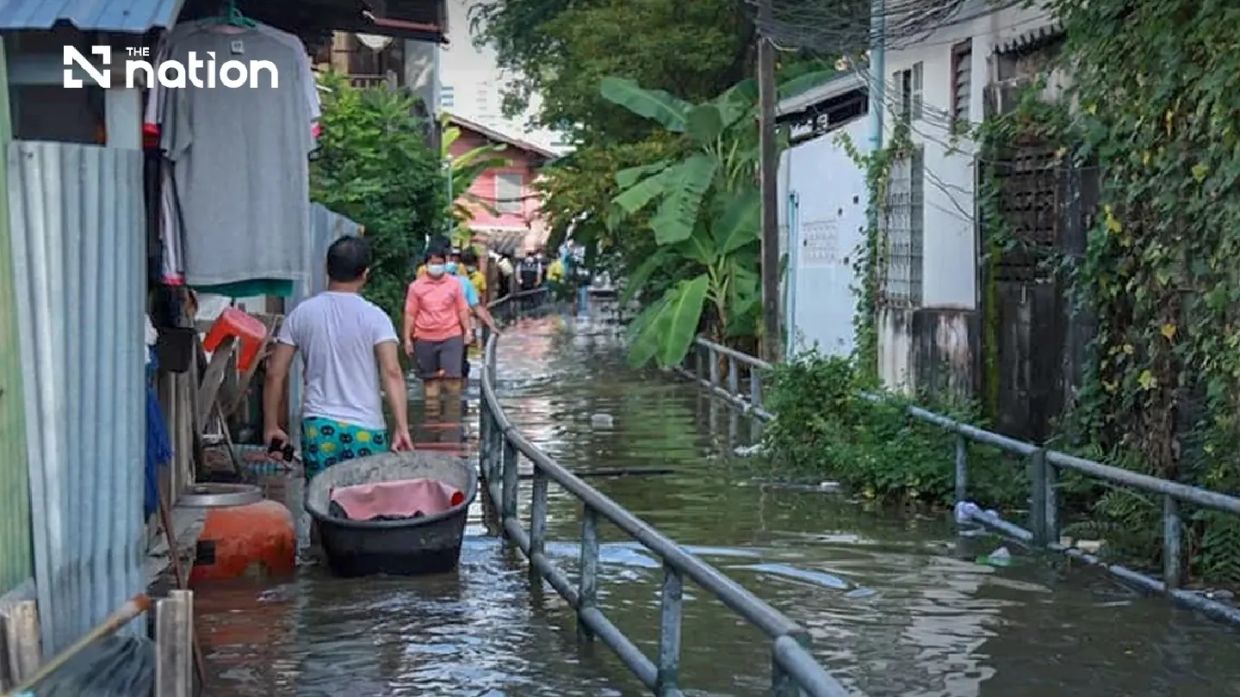
Thailand's Department of Disaster Prevention and Mitigation has placed seven jurisdictions on alert following forecasts of elevated water levels that could trigger flooding across the nation's central region. The warning covers Pathum Thani, Nonthaburi, Nakhon Pathom, Samut Sakhon, Samut Songkhram, and Samut Prakan provinces, alongside the Thai capital, with the critical period running from Monday, July 13, through Sunday, July 19. Officials have instructed all provincial governors and Bangkok's administration to activate preparedness measures immediately, particularly in areas with vulnerable populations and critical infrastructure.
The advisory stems from data compiled by the Royal Thai Navy's Hydrographic Department, which monitors ocean and river conditions across the country. Theerapat Kachamat, who heads the disaster prevention agency, disclosed the warning during a Saturday afternoon briefing, emphasizing the department's close coordination with naval authorities to track water behaviour in real time. According to hydrographic assessments, seawater intrusion into Thailand's major river systems will peak between 6 pm and 10 pm each evening during the warning week, creating a predictable window during which flood risks escalate significantly.
The specific concern centres on the Chao Phraya River, which bisects the central region and flows through Bangkok. Water level measurements taken at Phra Chulachomklao Fort, a strategic monitoring point where tidal influence is most pronounced, indicate that combined high tides and river flow will compress the river's capacity to absorb additional water. This convergence of factors—oceanic tidal surge meeting freshwater river discharge—creates conditions where banks lack sufficient freeboard to contain water, leading to overflow onto adjacent land. Areas most vulnerable include communities situated directly along the Chao Phraya and its tributaries, particularly those in districts identified by the warning as being at elevated risk.
Geographically, the threat is not uniformly distributed across the alert zone. In Pathum Thani, the administrative districts of Mueang Pathum Thani and Sam Khok have been singled out as particularly exposed. Nonthaburi faces concerns in its central district, plus Pak Kret and Bang Kruai, which abut the river's eastern bank. Nakhon Pathom's vulnerable zones include Bang Len, Nakhon Chai Si, and Sam Phran districts. Notably, all districts within Samut Songkhram—a coastal province where freshwater and saltwater systems intermingle—fall under heightened scrutiny. In Samut Prakan, the provincial capital's downtown and surrounding districts of Phra Samut Chedi, Phra Pradaeng, and Bang Bo warrant special attention, partly because these areas house riverside commercial zones and residential communities built at marginal elevations above normal water levels.
For Malaysian and Southeast Asian observers, this situation underscores the growing challenges posed by tidal and hydrological extremes across the region. Thailand's central plains, like Malaysia's own low-lying coastal areas and river deltas, represent densely populated economic zones where water management becomes increasingly critical. The Chao Phraya basin generates substantial agricultural output and supports millions of residents; any sustained flooding disrupts supply chains, damages crops, and strains urban infrastructure. This pattern mirrors concerns in Malaysian states such as Selangor and Johor, where seasonal high tides and monsoon rains regularly threaten communities and business operations.
The Central Disaster Prevention and Mitigation Command has directed provincial authorities to disseminate detailed information about the timing and expected intensity of high tides to stakeholders across economic sectors. Business operators running floating restaurants, riverside hotels, and industrial facilities along waterways must take precautions to secure assets and suspend operations if necessary during peak hours. Construction firms involved in riverbank reinforcement projects have been advised to halt work during the critical evening windows, as sudden water level changes could jeopardize worker safety and equipment. Municipal officials must also prepare contingency plans for flood response, including evacuation procedures for communities positioned in flood-prone areas outside existing protective barriers.
For ordinary residents living in riverside communities and low-lying neighbourhoods, the advisory carries practical implications. Families should prepare emergency kits, identify evacuation routes, and understand that while the high-tide windows are predictable—concentrated in the early evening hours—water ingress can persist once it begins. Elderly residents, young children, and individuals with mobility challenges warrant particular attention from local authorities. Informal settlements and slum communities lacking engineered flood defences are especially vulnerable, as they typically occupy the lowest ground and lack advanced warning systems or organized evacuation infrastructure.
Thailand's public communication strategy relies on digital accessibility through the THAI DISASTER ALERT application, which citizens can download to receive real-time updates specific to their locality. This technology-forward approach reflects the Thai government's recognition that timely, localized information saves lives. However, the reliance on smartphone applications also highlights a digital divide: elderly residents, those in poor or remote areas, and lower-income populations may lack consistent access to such platforms. Traditional media and community leaders remain essential conduits for ensuring warning messages reach all segments of the population.
For those requiring emergency assistance during the high-tide period, Thailand has established multiple reporting channels. The 1784 safety hotline operates round-the-clock, and residents can also submit incident reports and request aid through LINE by adding the official disaster management account. These redundant systems—combining phone hotlines, social media platforms, and mobile applications—reflect lessons learned from previous flooding events across Southeast Asia, where communication failures exacerbated humanitarian challenges. Coordination between national agencies, provincial governments, and local administrative structures will determine the effectiveness of response operations if flooding does materialize.
The timing of this alert carries significance for Thailand's economic and social rhythms. Mid-July coincides with the monsoon season in Southeast Asia, when elevated rainfall already challenges drainage systems and river capacity. High astronomical tides superimposed on monsoon-swollen rivers create compound flooding scenarios that exceed the severity of either phenomenon alone. This convergence of hazards is becoming a recurring reality across the region, prompting water resource managers and urban planners to reconsider infrastructure design standards. Countries including Malaysia, Vietnam, and Indonesia face similar pressures, as climate patterns and sea-level trends increase the frequency and magnitude of tidal extremes.
While the seven-day warning window allows authorities and citizens time to prepare, the episode also serves as a reminder that natural hazards in the Mekong region and broader Southeast Asia demand proactive governance and public engagement. Thailand's DDPM warning exemplifies an institutional approach to disaster risk reduction: monitoring environmental data, communicating risks transparently, and mobilizing resources to protect vulnerable populations. The success of such efforts ultimately depends on how effectively communities internalize the warnings and adjust their behaviour accordingly during the critical period ahead.

