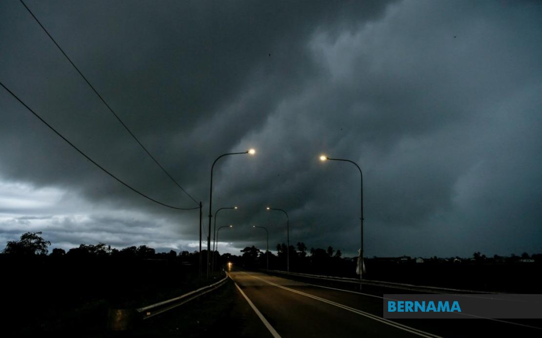
Severe weather conditions are bearing down on multiple regions across Malaysia, prompting the Malaysian Meteorological Department to issue a comprehensive weather warning covering Thursday afternoon. The alert encompasses thunderstorms, heavy rain, and strong wind gusts across a significant portion of Peninsular Malaysia alongside several districts in Sarawak, with the caution remaining active until 5 pm.
The western coast of Peninsular Malaysia faces particular exposure to these weather systems. The federal territories and key northern states are in the firing line, with Kuala Lumpur expected to experience the worst conditions alongside Perlis and Penang. Melaka on the southern coast similarly falls within the warning zone, indicating that this weather system is not confined to any single region but rather represents a broad atmospheric disturbance affecting the country's geography.
Kedah's vulnerability is concentrated in its northern and central districts, where administrative centres such as Kota Setar and Kubang Pasu face heightened risk. The warning extends through the less densely populated areas of Pokok Sena, Padang Terap, Kulim and Bandar Baharu, suggesting the system's reach covers both urban concentrations and rural zones. This broad geographic spread indicates a substantial weather system rather than isolated convective activity.
Peninsula's eastern coast is equally affected, with Terengganu's major districts of Marang, Dungun and Kemaman all included in the alert. Neighbouring Pahang experiences similar risks, with the warning covering both its highland region around Cameron Highlands and lower-lying areas including Lipis, Raub, Jerantut, Bentong and Bera. The inclusion of highland areas is particularly significant, as such regions can experience intensified rainfall and flash flooding during severe weather events.
Central Malaysian states face substantial exposure as well. Perak's warning zone spans from the coastal Manjung district through Central Perak to the southern regions of Bagan Datuk, Hilir Perak and Muallim. Selangor, the nation's most economically significant state, has multiple districts on alert including Sabak Bernam, Hulu Selangor, Gombak, Petaling and Hulu Langat. The inclusion of such densely populated and commercially important areas means the weather system has potential implications for business activity, transportation networks and daily routines affecting millions of residents.
Negeri Sembilan and Johor, representing the southern spine of Peninsular Malaysia, are similarly threatened. In Negeri Sembilan, the districts of Jelebu, Kuala Pilah, Jempol and Tampin are under warning. Johor's alert covers Tangkak, Muar, Batu Pahat and Johor Bahru, the state's capital and a major commercial hub. The extension of warnings into these southern territories suggests the weather system is moving across the entire peninsula rather than being confined to northern or central regions.
Across the South China Sea in Sarawak, the state's diverse geography faces comparable meteorological challenges. The warning encompasses western coastal and interior regions including Sri Aman and the southwestern districts of Betong, specifically Saratok and Kabong. Sarikei and Sibu, major urban and commercial centres, are also under alert, alongside the central zones of Mukah with its subdivisions of Dalat and Mukah town itself. The system's reach into Kapit's interior and the northern maritime areas of Bintulu and Miri, including the frontier districts of Subis and Miri town, demonstrates this is a comprehensive weather event affecting the entire state.
For residents and businesses across these affected zones, the immediate implications centre on disruption management. Heavy downpours can overwhelm drainage infrastructure, particularly in urban areas not designed for sudden intense rainfall. Strong winds pose risks to unsecured structures, outdoor installations and power distribution systems. The combination of factors—heavy precipitation coupled with strong gusts—creates conditions conducive to fallen trees, debris hazards and reduced visibility affecting transportation networks including highways, air services and maritime operations.
The afternoon-focused alert window until 5 pm suggests this represents the period of maximum meteorological severity. However, residents and authorities should prepare for conditions that may linger beyond this timeframe, as storms often move gradually and residual effects persist after the primary system passes. Those in flood-prone areas should remain particularly vigilant, as accumulated rainfall even after 5 pm can trigger delayed flooding in low-lying zones, particularly in areas with poor drainage or near watercourses.
The breadth of this warning across so many districts and states indicates MetMalaysia has detected a significant atmospheric disturbance rather than typical afternoon thunderstorms. Such comprehensive alerts typically precede weather systems capable of causing material impact, making preparedness essential. Residents should secure loose outdoor items, avoid unnecessary travel during peak conditions, and monitor official updates for evolving forecasts, as weather situations can intensify or shift unexpectedly.
Businesses and public services across these regions should implement contingency measures. Schools may need to adjust dismissal procedures, outdoor events require postponement or relocation, and construction sites must secure equipment and personnel. The warning's geographic scope—spanning nearly the entire peninsula plus Sarawak—suggests national weather patterns are significantly disrupted, making coordination between federal, state and local authorities essential for effective response.

