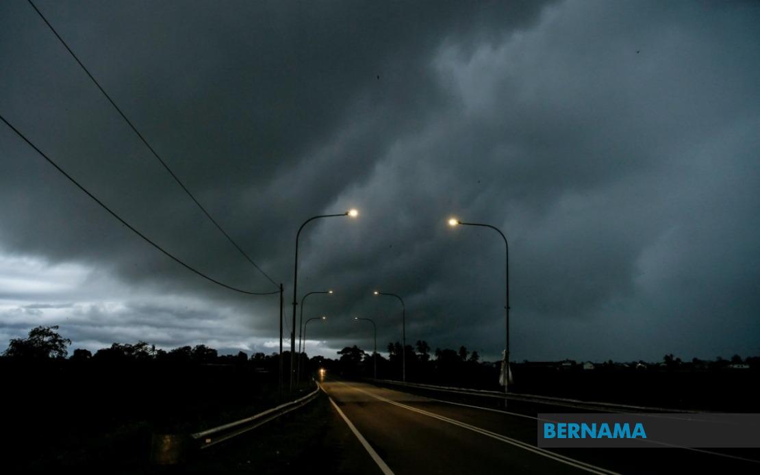
Weather authorities across Malaysia have activated severe weather alerts affecting a significant portion of the country's populated regions. The Malaysian Meteorological Department released a comprehensive warning on July 7 cautioning residents and commuters in nine states, the federal territories of Kuala Lumpur and Putrajaya, and areas across Sarawak and Sabah to prepare for potentially hazardous atmospheric conditions lasting through the evening hours until 6 PM. The warning encompasses thunderstorms accompanied by heavy precipitation and gusty winds that could impact both urban centres and rural communities across the peninsula and East Malaysia.
In Peninsular Malaysia, the alert covers substantial portions of four key regions. Johor, which regularly experiences monsoon-influenced weather patterns, falls within the warning zone along with Negeri Sembilan. The advisory extends to multiple divisions within Perak, affecting the northern interior areas of Hulu Perak and Kuala Kangsar as well as the industrial heartland zones of Kinta, Kampar, and Hilir Perak, plus the rural district of Batang Padang and Muallim. This wide geographic spread across Perak indicates that weather systems are capable of generating severe conditions across both highland and lowland terrain.
The east coast states face particular vulnerability under this alert. In Kelantan, six districts have been flagged for dangerous conditions including the coastal municipalities of Tumpat and Pasir Mas, alongside inland areas such as Jeli, Tanah Merah, Kuala Krai, and Gua Musang. Terengganu's warning encompasses its primary urban centre of Kuala Terengganu together with the coastal district of Setiu and Kuala Nerus, extending to the southern districts of Marang, Dungun, and Kemaman. Pahang, the nation's largest state, sees warning coverage across its Cameron Highlands tourism region, the administrative centre of Temerloh, the economic hub of Kuantan, and the districts of Bentong, Bera, Pekan, and Rompin, demonstrating the widespread nature of the atmospheric disturbance.
The Klang Valley and surrounding Selangor areas represent another critical alert zone given their dense urban population. The warning encompasses seven Selangor districts spanning from the coastal Sabak Bernam and Kuala Selangor in the west through the capital fringe areas of Hulu Selangor, Gombak, and Petaling to the eastern suburbs of Hulu Langat and Sepang. Combined with the alert for Kuala Lumpur and Putrajaya, this advisory directly affects millions of residents in Malaysia's most densely populated region and the country's administrative centre, potentially disrupting commuter patterns and business operations during peak evening hours.
East Malaysia faces equally extensive warnings under this advisory. Sarawak's coverage includes the state capital Kuching along with the Sibu division encompassing Kanowit, the Mukah area, and the Kapit division including Song. The warning extends to Bintulu and its neighbouring Sebauh region plus the northern divisions of Miri with its sub-districts of Subis, Beluru, and Marudi alongside Limbang. The breadth of this alert across Sarawak indicates that a significant weather system is capable of generating severe conditions across the entire southern and central portions of the state.
Sabah's alert zone demonstrates similar geographic extent with coverage across three major regions. The interior plateau districts of Sipitang, Tenom, Beaufort, Nabawan, Keningau, and Tambunan face the advisory alongside the more populated west coast areas including Papar, Penampang, Kota Kinabalu, Tuaran, and Ranau. The eastern division of Sandakan and its component districts of Tongod, Telupid, Beluran, and Sandakan complete the coverage, meaning severe weather threats span from Sabah's interior agricultural regions to its primary urban and commercial centres.
Thunderstorm warnings of this magnitude and geographic scope typically indicate either monsoon-influenced wind patterns or the development of significant atmospheric convection systems capable of generating hazardous conditions. The combination of thunderstorms with heavy rainfall creates particular risks for flash flooding in low-lying areas, while strong winds pose dangers to structures and transportation infrastructure. Evening timing through 6 PM means the most severe conditions may coincide with the conclusion of the working day and evening commute period, potentially affecting substantial numbers of people travelling or conducting outdoor activities.
Residents across affected areas are advised to take standard precautions during such weather alerts. This includes avoiding outdoor activities during the warning period, securing loose items that could be displaced by strong winds, and remaining alert to rapidly changing conditions. Motorists should exercise heightened caution on roads, particularly in areas prone to flooding or where reduced visibility from heavy rain could complicate navigation. Authorities typically enhance monitoring of flood-prone locations and maintain readiness to respond to weather-related emergencies during such warnings.
The geographic extent of this alert across peninsular Malaysia and both East Malaysian states reflects the dynamic nature of tropical weather systems capable of affecting multiple regions simultaneously. Given Malaysia's position in the equatorial zone and its exposure to monsoon patterns, such widespread warnings occur periodically throughout the year, particularly during transitional seasons. The Malaysian Meteorological Department's decision to issue this comprehensive alert demonstrates the significance attributed to the forecasted atmospheric conditions and the potential impact on public safety and commerce across the nation's major population and economic centres.

