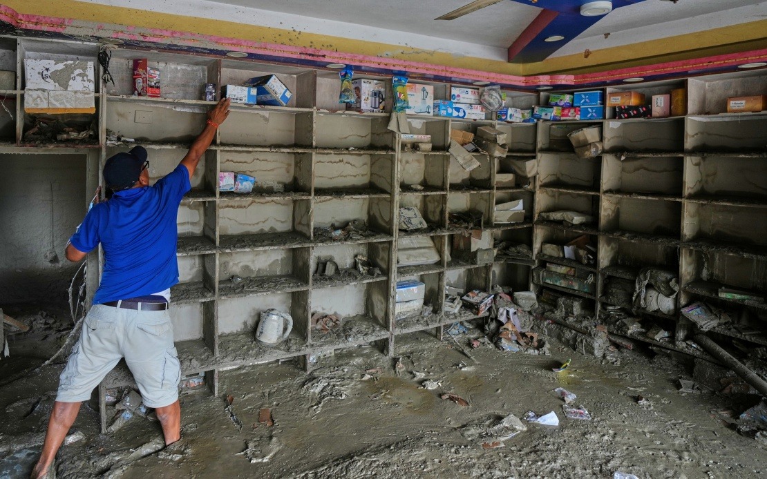
A catastrophic mudslide that struck Gyirong Port in southwest China's Xizang Autonomous Region on August 26 originated from a glacier collapse high in the Nepalese Himalayas, according to findings released by regional authorities on Sunday. The disaster demonstrates how transnational environmental hazards in the mountainous Asia-Pacific region can rapidly escalate from localised events into cross-border catastrophes affecting multiple nations and communities.
The sequence of geological events began when a glacier situated on the south slope of Mount Langtang Lirung in Nepal fractured at approximately 5,200 metres elevation. This fracture initiated an ice-rock avalanche that descended with tremendous velocity, gathering momentum and debris as it plummeted nearly 1,200 metres in elevation to around 4,000 metres. The violent cascade of ice, rock, and earth transformed into a massive debris flow that continued its destructive path across the mountainous terrain.
The debris flow maintained considerable force as it travelled approximately 22 kilometres from its origin point before reaching Gyirong Port, situated at roughly 1,800 metres altitude. The sheer distance covered by this mudslide underscores the immense energy released by the initial glacier fracture and the efficiency with which mountainous terrain channels such disasters toward populated areas. The destructive power remained concentrated enough to flatten approximately 0.7 square kilometres of land surrounding the port settlement.
The physical devastation at Gyirong Port proved substantial and indiscriminate. The mudslide destroyed 27 buildings and associated infrastructure facilities, obliterating structures that formed the backbone of this remote border community. Beyond the immediate structural damage, the disaster created a humanitarian crisis of significant proportions. As of Saturday evening, regional authorities confirmed 16 confirmed deaths, with 546 individuals reported missing—numbers that underscore both the speed and scale of the disaster's impact on the local population.
China's scientific response to the disaster reveals the growing sophistication of cross-border environmental monitoring in the region. The cryosphere emergency disaster response team from the Institute of Mountain Hazards and Environment, operating under the Chinese Academy of Sciences, rapidly mobilised to determine the disaster's origins and mechanisms. Their investigation drew upon multiple data sources including remote-sensing monitoring information, field-transmitted data streams, and comprehensive on-site surveys, enabling them to establish with confidence that the Nepalese glacier collapse triggered the downstream catastrophe.
For Malaysia and other Southeast Asian nations, this incident illustrates the interconnected nature of environmental risks in a region characterised by complex mountainous topography and significant glacial systems. The Himalayan and Hindu Kush ranges, which stretch across multiple nations including Nepal, China, Bhutan, and India, contain numerous glaciers susceptible to destabilisation through climate change, seasonal temperature fluctuations, and natural geological processes. When these glaciers fail, the consequences extend far beyond their immediate location, affecting communities and infrastructure in downstream regions across international boundaries.
Climate change represents an underlying concern that exacerbates glacier instability throughout the Himalayan system. Warming trends documented across the region have accelerated glacier retreat and increased the frequency of sudden collapses and avalanches. Scientists monitoring these systems warn that events similar to the Mount Langtang Lirung incident may become increasingly common as atmospheric warming continues to destabilise high-altitude ice formations. For nations sharing glaciated mountain systems, this trajectory presents profound challenges for infrastructure planning, disaster preparedness, and international cooperation frameworks.
The Gyirong Port incident also highlights vulnerabilities in remote border communities that depend economically on mountain trade corridors and cross-border commerce. The settlement's location on a crucial China-Nepal trade route made it strategically important but physically exposed to natural hazards originating from the surrounding peaks. Similar communities throughout the Himalayan region and across Southeast Asia's mountain zones face comparable risks from avalanches, mudslides, and debris flows that originate in glaciated areas and funnel toward populated settlements below.
International cooperation becomes essential for managing such transnational environmental hazards. Nepal and China's ability to share scientific findings and coordinate disaster response demonstrates one model of cross-border collaboration, though institutional frameworks for such cooperation remain underdeveloped across much of Asia. Regional organisations and bilateral arrangements would benefit from strengthened protocols for early warning systems, real-time data sharing, and coordinated evacuation procedures when mountain hazards threaten border communities.
For Malaysian policymakers and regional observers, the Gyirong Port disaster reinforces several strategic considerations. First, environmental risks transcend political boundaries, requiring diplomatic channels and technical cooperation to manage effectively. Second, climate-driven changes to mountain systems generate cascading hazards that demand investment in monitoring infrastructure and early warning capabilities. Third, communities in vulnerable locations require enhanced disaster preparedness and resilience-building measures that account for the possibility of catastrophic events originating from distant sources. The incident underscores how geological processes, operating across borders and above populated areas, demand integrated regional approaches to risk management and scientific collaboration.

