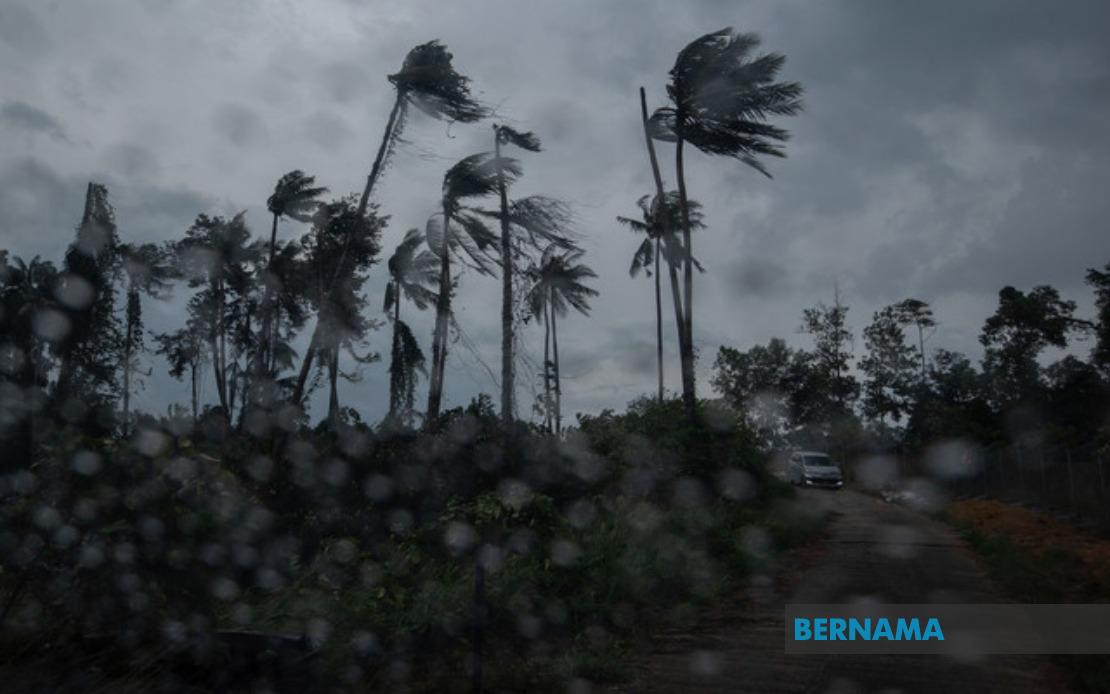
The Malaysian Meteorological Department (MetMalaysia) has cautioned residents and commuters across a broad swath of the nation to prepare for dangerous weather conditions, issuing an alert covering thunderstorms, torrential rain and gusty winds spanning multiple states until 6 pm. The comprehensive warning reflects the agency's assessment of atmospheric instability affecting distinct geographic zones simultaneously, requiring heightened vigilance from the public and emergency services.
Across Peninsular Malaysia's east coast region, Kelantan faces particular exposure, with nine districts identified in the warning zone: Tumpat, Pasir Mas, Kota Bharu, Jeli, Tanah Merah, Bachok, Machang, Pasir Puteh and Kuala Krai. This concentration along Kelantan's landscape suggests a concentrated weather system capable of producing localised flooding and surface water accumulation. Neighbouring Terengganu also remains vulnerable, affecting Besut, Setiu, Kuala Nerus and Kemaman as moisture-laden air masses interact with the state's topography.
Pearak's interior and lowland zones represent another focal point of concern, with MetMalaysia listing Kinta, Perak Tengah, Kampar, Hilir Perak, Batang Padang and Muallim. The inclusion of such diverse terrain suggests meteorologists are tracking instability capable of impacting both highland and coastal communities. Langkawi in Kedah, despite its island geography, falls within the warning perimeter, indicating atmospheric conditions transcending conventional peninsular weather patterns.
Pahang experiences widespread coverage under the alert, encompassing both highland and lowland districts: Cameron Highlands, Lipis, Raub, Bentong, Temerloh, Kuantan, Bera, Pekan and Rompin. This expansive listing underscores the state's geographic vulnerability to tropical weather systems. In the Klang Valley region, Selangor's Hulu Selangor and Gombak face the same threat, potentially disrupting the nation's economic heartland and affecting commuter networks.
Southern Peninsular Malaysia also remains within the alert framework. Negeri Sembilan's Jempol and Tampin, alongside Johor's Tangkak, Segamat, Kluang, Mersing and Kota Tinggi, indicate the system's southward reach. Johor's extensive listing reflects the state's size and varied landscape, from inland plateaus to coastal lowlands susceptible to rapid weather deterioration.
Beyond Peninsular Malaysia, Sabah faces substantial exposure across both its interior and coastal zones. The Interior region encompasses Sipitang, Tenom, Beaufort, Keningau and Tambunan, while the West Coast alert zone includes Papar, Putatan, Penampang, Kota Kinabalu and Tuaran—the state's population centre. Additional warnings extend to Lahad Datu in Tawau and Kinabatangan in Sandakan, spanning the state's eastern reaches. This comprehensive coverage reflects Sabah's position within equatorial weather systems regularly generating severe atmospheric activity.
Sarawak's inclusion brings the alert to Malaysian Borneo's larger landmass, specifically targeting Tatau and Sebauh in Bintulu, Subis in Miri, and Limbang. While fewer districts are flagged compared to Peninsular counterparts, the listing suggests meteorologists identify distinct convective activity warranting precautionary measures across the state's diverse regions.
The 6 pm deadline provided by MetMalaysia establishes a defined forecast horizon, though weather systems frequently persist beyond initial projections. Residents and authorities should recognise this timeline as a minimum threshold rather than definitive conclusion, with conditions potentially extending into evening hours depending on atmospheric evolution. The combination of thunderstorms, heavy precipitation and strong winds creates compounding hazards: lightning strike risk, surface water flooding, wind damage to structures and vegetation, and reduced visibility affecting road users.
For maritime interests, including fishing communities and commercial shipping operating from affected ports, the warning carries particular significance. Coastal areas including Mersing, Kota Tinggi, Kinabatangan and Subis face additional sea state deterioration alongside onshore impacts. Heavy rainfall in highland zones like Cameron Highlands and Tambunan may precipitate downstream flooding in lower-lying communities within hours as water courses swell.
Transportation networks warrant special attention, particularly highways traversing warned districts. The combination of heavy rain and strong winds compromises vehicle stability and driver visibility, while lightning risk necessitates precautionary measures for exposed infrastructure and personnel. Public transport operators should maintain heightened alert status and consider contingency protocols if conditions deteriorate beyond forecast severity.
Emergency management agencies across affected states should activate monitoring systems and ensure rapid response capabilities. Pre-positioning rescue equipment and personnel in vulnerable districts optimises intervention capacity should flooding or wind damage occur. Communication channels linking MetMalaysia updates to emergency operations centres enable real-time decision-making and public advisories.
The geographic scope of MetMalaysia's alert—encompassing approximately 40 percent of the nation's land area—reflects significant atmospheric instability rather than isolated weather phenomena. This systemic pattern warrants broader consideration of monsoon dynamics and seasonal rainfall distribution affecting Malaysian weather patterns during this July period.

