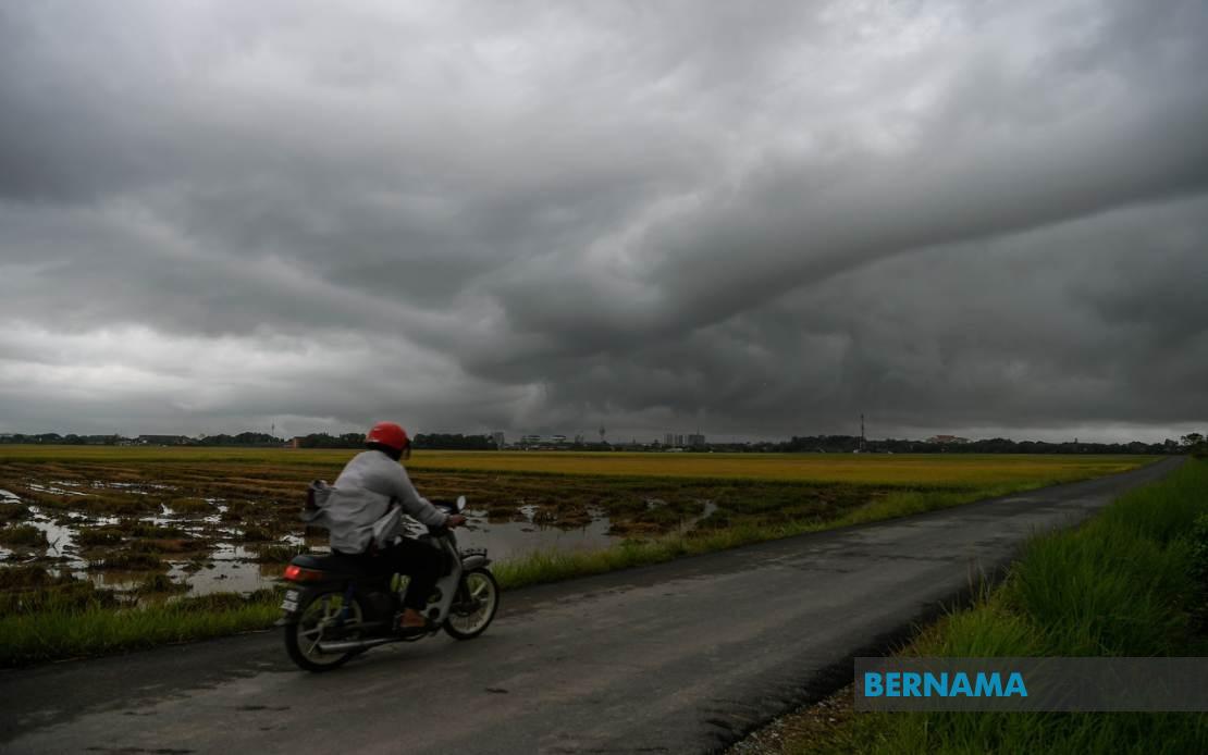
The Malaysian Meteorological Department has cast a wide net with its latest severe weather alert, warning residents and travellers across much of the country to prepare for intense atmospheric conditions. Until 9 pm today, multiple regions spanning Peninsular Malaysia as well as the East Malaysian states of Sarawak and Sabah, alongside the Federal Territory of Labuan, face the prospect of thunderstorms accompanied by substantial rainfall and gusty winds. The geographical scope of the alert underscores the scale of the weather system moving through the region, affecting everything from rural districts to major urban centres.
In the northern corridor, the Department has flagged vulnerable zones across Kedah and Penang as priority areas. The Kedah districts of Kuala Muda, Baling, Kulim and Bandar Baharu sit directly in the path of the anticipated storms, as do four regions within Penang itself—the Northeast district alongside the three divisions of Seberang Perai. This concentration in the north reflects a typical pattern during monsoon-influenced weather systems that frequently sweep down the peninsula from the Strait of Malacca, bringing moisture-laden maritime air inland.
Moving southward, Perak presents an expansive threat zone covering ten administrative divisions, from the western coastal plains near Kerian through the interior highlands towards the east. The inclusion of Cameron Highlands in the Pahang section of the warning is particularly noteworthy for agricultural operations and tourism, given the area's elevation and the intensity that storms can achieve in highland terrain. The Department has also identified all areas within Kelantan as vulnerable, signalling that the entire state faces uniform risk from the incoming system.
The east coast states of Terengganu and Pahang, historically exposed to seasonal weather volatility, feature prominently in the alert. Six districts across Terengganu—from Besut in the north to Kemaman in the south—require precautions, while six Pahang locations including the cooler highlands and coastal reaches like Pekan and Rompin demonstrate the system's reach across terrain of varying topography. This regional consistency suggests a large-scale atmospheric disturbance rather than isolated convective activity.
In the southern region, Johor's commercial and logistical heartland faces considerable disruption potential. Eight districts have been flagged, encompassing Johor Bahru's urban expanse, the critical port and industrial areas around Pasir Gudang and Tanjung Pelepas, as well as interior zones. The warning for Johor carries practical implications for the state's significant transport infrastructure, including the North-South Expressway and the Singapore causeway, where visibility and road conditions may deteriorate significantly.
East Malaysia's inclusion in this unified warning demonstrates the scale of the meteorological phenomenon. In Sarawak, five divisional zones have been identified: Sibu and Mukah in the central coast, the inland Kapit district, Bintulu on the southern coast, and Miri in the remote northern reaches. These regions, often dependent on river transport and domestic aviation, may experience service disruptions if visibility drops sharply or wind speeds exceed safety thresholds for small aircraft operations.
Sabah's affected areas span both the interior divisions and the west coast, encompassing Sipitang, Kuala Penyu, Beaufort and Tambunan in the interior, while Papar, Penampang and Ranau face threats from the western slope. The inclusion of Labuan, positioned strategically in the Brunei Bay, rounds out a coverage area that stretches across more than 800 kilometres from north to south and encompasses entirely different maritime and terrestrial zones.
For Malaysian residents and businesses, the practical implications of such a widespread alert are substantial. The thunderstorm warning typically accompanies risks of flash flooding in low-lying areas, particularly in drainage-challenged urban zones where the combination of heavy rain and strong winds can overwhelm drainage systems within minutes. Agricultural operations across these regions face potential crop damage from wind shear and waterlogging, while construction sites and outdoor events require immediate contingency planning.
The timing of the alert—persisting until 9 pm—suggests a system that meteorologists anticipate will weaken or move away during the evening hours. However, the breadth of the warning across such diverse geographical areas indicates that this is not a simple afternoon convection pattern but rather a more organised weather system, possibly influenced by seasonal monsoon dynamics or the interaction between sea and land breezes at scales that meteorological departments cannot predict with pinpoint accuracy more than a few hours in advance.
Travellers should exercise caution on highways and in airports, as visibility during thunderstorms can reduce dramatically and wind shear presents hazards to high-sided vehicles. Drivers are advised to reduce speed, activate hazard lights if stopping, and avoid using mobile devices while navigating poor visibility. Those planning evening activities or travel should monitor official updates from MetMalaysia, as conditions can escalate rapidly once convective systems develop fully, particularly in areas where terrain funnels moisture-laden winds into concentrated zones.

