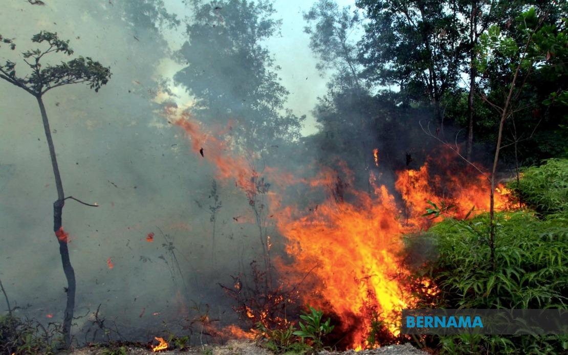
The Malaysian Fire and Rescue Department (JBPM) has sounded fresh alarm over the escalating open burning problem gripping the nation, with preliminary data for 2024 painting a significantly grimmer picture than the year before. From January through July, authorities logged 18,432 separate incidents involving controlled burns that spiraled beyond intention in forests, shrublands, and waste areas across the country. This represents a dramatic 85 percent jump compared to the 9,941 cases recorded during the corresponding seven-month window in 2023, underscoring a worsening trend that has captured the attention of senior fire management officials and environmental watchdogs alike.
The acceleration extends beyond year-on-year comparisons. Fire department director-general Datuk Seri Nor Hisham Mohammad revealed that even when measured against 2024 figures from the same January-to-July period, the current tally of 18,432 cases still outpaces the 16,294 incidents documented two years ago. The progression suggests that Malaysia faces mounting pressure from uncontrolled burning across multiple regions and terrain types, each presenting distinct operational challenges for response teams and necessitating increasingly sophisticated resource allocation strategies.
In response to this worrying trajectory, JBPM has implemented a targeted surveillance initiative focused on geographical hotspots identified through historical analysis. The department is now actively monitoring 183 locations throughout Malaysia that have demonstrated consistent vulnerability to open burning incidents based on a comprehensive five-year record review. This data-driven approach represents a significant tactical shift, allowing the agency to concentrate firefighting capacity and prevention efforts where empirical evidence indicates greatest need rather than adopting blanket nationwide strategies.
Within this broader monitoring framework, authorities have isolated a particularly acute subset of concern: 62 locations deemed at substantial risk for catastrophic fires capable of engulfing areas larger than 25 hectares. Fires of such magnitude present extraordinary logistical complications for JBPM's field operations, requiring simultaneous mobilization of multiple teams, specialized equipment, and inter-agency coordination across potentially difficult terrain. The identification of these 62 zones signals the department's recognition that certain geographic areas, whether due to vegetation density, weather patterns, accessibility constraints, or human settlement proximity, warrant heightened vigilance and pre-positioned resources.
Geographically, the distribution of high-risk incidents reveals regional disparities that reflect diverse environmental and socioeconomic factors. Sarawak has emerged as a particular flashpoint, with large-scale open fires currently burning in areas including Sri Aman and Mukah, suggesting that conditions in East Malaysia—encompassing dense jungle vegetation, agricultural expansion pressures, and seasonal weather patterns—create especially volatile circumstances for fire propagation. Peninsular Malaysia has recorded substantial incident numbers as well, though many are contained to smaller areas, indicating different environmental conditions or more effective localized suppression efforts.
Sabah's inclusion among priority monitoring zones reflects the state's distinctive geographical challenges. The combination of verdant vegetation and rugged topography creates conditions where fires spread with remarkable speed once ignited, and terrain complexity substantially hampers firefighting team access and effectiveness. The fire department has identified seven locations around Kota Kinabalu alone that experienced significant fire incidents in 2024, and these areas feature prominently among the 62 nationwide high-risk zones requiring continuous oversight and rapid-response readiness.
The underlying drivers of Malaysia's escalating open burning crisis remain multifaceted but increasingly well understood by environmental and fire management authorities. Nor Hisham identified elevated temperatures in specific regions as a primary contributing factor, a concern that carries particular weight given Malaysia's tropical climate and susceptibility to global weather phenomena. When atmospheric conditions become hotter and drier than baseline seasonal norms, vegetation moisture content drops sharply, dramatically lowering the ignition threshold and accelerating fire spread once burning begins.
Looking ahead, Malaysian fire management agencies are bracing for potential intensification of burning pressures stemming from broader meteorological patterns. The anticipated Super El Niño phenomenon expected to develop in the Pacific Ocean around November represents a significant concern for JBPM's forward planning. While El Niño effects typically manifest months after its Pacific genesis, Malaysian officials anticipate that the climatic consequences—including reduced rainfall, elevated temperatures, and extended dry seasons—will reach the nation during the third or fourth week of January in the following year.
These anticipated climate shifts have prompted JBPM to initiate preemptive preparation strategies rather than awaiting crisis conditions. The department is actively incorporating meteorological forecasts and Super El Niño impact projections into resource deployment, team training schedules, equipment maintenance cycles, and inter-agency coordination protocols. This proactive stance reflects lessons learned from previous major fire seasons, when simultaneous high-temperature conditions and reduced moisture availability overwhelmed response capabilities and necessitated calling in military units and cross-border assistance.
For Malaysian readers and regional observers, the implications extend beyond immediate fire management concerns. The surge in open burning incidents intersects with broader questions about land use management, agricultural practices, industrial waste disposal protocols, and enforcement of environmental regulations. Whether the increase reflects genuine acceleration in burning incidents or improved detection and reporting systems remains partially ambiguous, yet either explanation carries policy relevance.
The concentration of high-risk zones in Sabah and Sarawak underscores the particular environmental vulnerabilities of Malaysian Borneo, where development pressures, logging operations, agricultural expansion, and natural vegetation density create explosive combinations. These states account for disproportionate fire risk despite lower population density, suggesting that land-use choices and land-use transition processes—not merely human density—drive burning patterns.
From a Southeast Asian perspective, Malaysia's open burning crisis reflects challenges confronting the broader region, where transboundary haze from uncontrolled fires has repeatedly sparked diplomatic tensions and regional public health emergencies. The 2023 haze episode affecting Singapore and the broader region reminded neighbors of Malaysia's role as both source and receptor of transboundary air pollution, making the 85 percent increase in documented burning incidents a matter warranting regional attention and potential cooperative response mechanisms under ASEAN frameworks.
The coming months will test whether JBPM's enhanced monitoring protocols, preemptive resource positioning, and meteorological integration prove sufficient to constrain fire impacts as El Niño influences approach. Success requires not only departmental readiness but also complementary efforts in land-use enforcement, agricultural practice modification, and public awareness campaigns that discourage deliberate burning.

