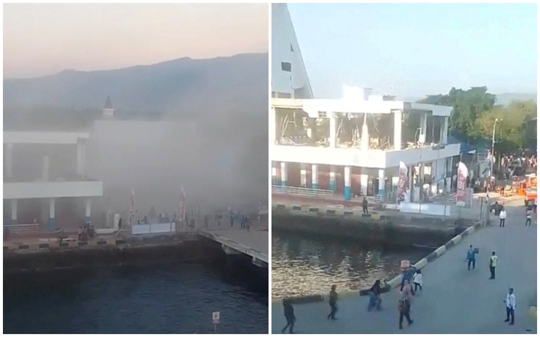
A devastating earthquake measuring 7.7 magnitude struck off the coast of Flores Island in Indonesia's eastern region on Saturday morning, leaving a trail of destruction across multiple communities. The seismic event, which originated near Mbay town in Nagekeo Regency, has claimed at least 20 lives according to officials coordinating emergency response efforts in the disaster zone. Fathur Rahman, an official from the Maumere Search and Rescue Office, confirmed the casualty figures while noting that six additional people sustained injuries from the initial tremor and its powerful aftershocks.
The human toll extends beyond those confirmed dead, as rescue personnel are still searching for two individuals reported missing and presumed trapped beneath collapsed structures. The scale of the casualties underscores the violent force unleashed by the earthquake, which triggered multiple strong aftershocks in the hours following the initial shock. These secondary tremors compounded the danger faced by residents attempting to evacuate damaged areas and hindered early rescue and recovery operations across the affected communities.
Governor Melki Laka Lena of East Nusa Tenggara province painted a grim picture of the physical destruction during a press conference held in Kupang. Numerous residential buildings and homes sustained significant damage ranging from partial collapse to complete destruction, while critical infrastructure including roads suffered severe disruption. Landslides triggered by the earthquake have blocked or cut off several key routes, creating serious obstacles for rescue teams attempting to reach isolated communities and transport injured residents to medical facilities. Provincial authorities acknowledged that comprehensive damage assessments are still underway, suggesting the full scope of the disaster may not yet be apparent.
Social media footage circulating from the disaster zone captured haunting images of buildings crumbling into clouds of dust and debris as residents fled in panic. Videos showed frightened people running into streets seeking safety from falling structures, illustrating the sudden chaos that erupted when the ground began shaking violently. These visceral accounts provided raw evidence of the earthquake's destructive power and the terror experienced by those caught in the initial moments of the disaster.
The immediate aftermath saw significant disruptions to regional transportation and commerce. Airlines cancelled multiple flights serving East Nusa Tenggara province, effectively isolating the region and complicating efforts to mobilise additional emergency personnel and relief supplies. This aviation shutdown reflected both the dangerous conditions posed by ongoing seismic activity and the precautionary measures adopted by carriers concerned for passenger and crew safety.
Indonesia's Meteorology, Climatology and Geophysics Agency initially issued a tsunami warning following the earthquake, raising fears of a second catastrophe that could compound the death toll. However, the agency subsequently lifted the warning after careful monitoring of coastal water movements. Despite this relief, officials continued urging residents to maintain heightened vigilance for potential aftershocks and to avoid coastal areas where secondary tsunamis could still pose risks if additional seismic activity occurred.
Foreign governments and diplomatic missions moved quickly to ensure the safety of their citizens in the affected region. The Chinese Consulate General in Denpasar issued an alert specifically targeting Chinese nationals, with particular concern for tourists concentrated in Labuan Bajo, a popular coastal destination. The consulate advised citizens to monitor official earthquake and disaster warnings closely, exercise caution regarding aftershock risks, and maintain a safe distance from beach areas where secondary tsunami waves might reach if triggered by subsequent seismic events.
For Malaysian and Southeast Asian observers, the Flores Island earthquake serves as a sobering reminder of the region's significant seismic vulnerability. Indonesia straddles the Pacific Ring of Fire and represents one of Earth's most geologically active zones, with earthquakes posing an ongoing threat to millions of residents across the archipelago. The incident underscores the importance of robust disaster preparedness infrastructure, early warning systems, and coordinated regional response mechanisms that can mobilise assistance across borders when catastrophic natural disasters strike vulnerable communities.
The earthquake's timing and location presented particular challenges for emergency responders. The early Saturday morning strike occurred when many residents remained in homes or other structures, maximising the potential for casualties when buildings collapsed. Eastern Indonesia's more remote geography compared to densely populated Java also means that affected communities often experience greater isolation during emergencies, complicating logistics for rescue operations and medical care provision. Road damage from landslides compounds this isolation, potentially leaving some villages cut off from outside assistance for extended periods.
Rescue teams continued working methodically through debris fields to locate survivors and assess damage across the affected region. Officials indicated that further casualty and destruction updates would emerge as emergency operations progressed through subsequent days. The ongoing search efforts and data compilation process suggested that final casualty figures and damage assessments might yet change as rescue personnel reached previously inaccessible areas and completed comprehensive surveys of destroyed infrastructure. The continued threat of aftershocks added urgency and danger to these recovery operations, as rescue workers laboured amid the possibility of further ground movement that could trigger additional collapses.
The broader implications for Indonesia's disaster management capabilities remain evident in how authorities coordinated responses across provincial boundaries and engaged international diplomatic channels. The rapid provision of information to foreign consulates and the issuance of clear public warnings demonstrated established protocols for handling major seismic events. However, the incident also highlighted ongoing challenges in ensuring that remote communities receive adequate advance warning and that post-earthquake aid reaches isolated populations quickly despite terrain and infrastructure obstacles that characterise much of eastern Indonesia's geography.

