Colombia faces an exceptionally challenging period as the nation simultaneously confronts two major natural disasters that have overwhelmed emergency response capabilities. A severe and rapidly escalating wildfire crisis has engulfed hundreds of municipalities nationwide, creating an unprecedented strain on disaster management agencies already mobilised to their maximum capacity following a devastating 7.4 magnitude earthquake that struck on August 10. The combination of these two catastrophic events has forced authorities to stretch limited resources across multiple simultaneous crises, raising serious concerns about the adequacy of emergency response infrastructure in the country.
The scale of the wildfire emergency is staggering by any measure. According to the Institute of Hydrology, Meteorology and Environmental Studies (IDEAM), a total of 344 municipalities have been placed under red alert status due to wildfire threats. This represents a shocking 93 per cent increase in affected areas within a single day, reflecting the extreme velocity at which the fires are advancing across the Colombian landscape. The unprecedented surge underscores how quickly environmental conditions can deteriorate and how rapidly fire threats can proliferate when atmospheric and ground conditions align to create a catastrophic scenario.
Metropolitan zones and rural areas alike are experiencing the effects of this conflagration wave. The National Unit for Disaster Risk Management reported that dozens of active fires are concentrated predominantly in six departments: Tolima, Cesar, Norte de Santander, Antioquia, Narino and Santander. These regions span diverse geographical zones ranging from tropical lowlands to mountainous terrain, indicating that the fire threat is not geographically limited but rather presents a nationwide challenge affecting varied ecosystems and population centres across Colombia's territory.
The environmental and economic damage quantified so far paints a bleak picture of the crisis's destructive impact. Officials have documented that destroyed vegetation, agricultural land and residential structures have already exceeded 11,000 hectares across multiple municipalities. In terms of direct measurement, this translates to approximately 27,182 acres of landscape consumed by fire, representing significant loss of arable land, forest resources and human settlements. Given the ongoing nature of the fires and their rapid spread, these figures represent merely a snapshot of the cumulative damage, with further deterioration virtually certain as the emergency continues.
Authorities have mobilised an impressive array of resources in an attempt to contain the advancing flames. Emergency response has involved deploying firefighters, military units, general emergency personnel and aerial support infrastructure in an intensive effort to combat the blazes across the affected regions. However, despite these substantial commitments, officials acknowledge that current staffing levels remain inadequate to the scale of the emergency. Fire crews originating from various departments, including Risaralda—itself a region significantly affected by the August earthquake—have been reassigned to wildfire containment duties. This redeployment, while necessary, simultaneously redirects resources away from earthquake recovery and reconstruction operations that remain critical in the immediate post-disaster phase.
Understanding the meteorological drivers behind this crisis is essential to grasping why conditions have become so explosive. The combination of severe heat and abnormally dry atmospheric conditions has created ideal circumstances for rapid fire propagation and spread. These conditions are not temporary aberrations but rather reflect broader climate patterns. IDEAM projections indicate a 90 per cent probability that the El Niño phenomenon will persist through the first quarter of 2027, with intense heat anomalies anticipated to intensify toward the conclusion of 2024. This forecast suggests that Colombia's environmental stress will remain acute throughout the remainder of the year and well into 2025, potentially creating conditions for sustained wildfire activity and similar disasters in coming months.
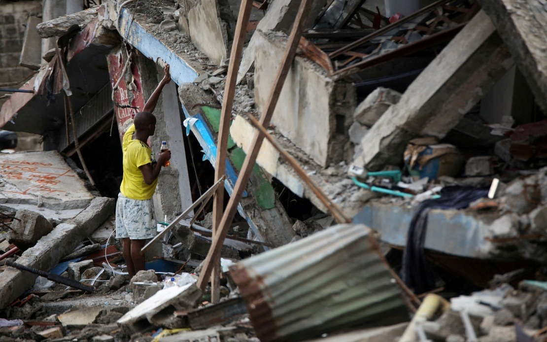
The earthquake that preceded this wildfire crisis has already inflicted substantial casualties and destruction that continues to demand urgent attention from recovery agencies. Official reports from the disaster management unit document 288 deaths directly attributable to the August 10 seismic event, with an additional 4,018 individuals sustaining injuries of varying severity. The scale of structural damage is equally concerning, with 12,504 homes completely destroyed and more than 80,000 structures sustaining damage ranging from moderate to severe. These figures represent not merely statistics but reflect the displacement, economic hardship and psychological trauma affecting hundreds of thousands of Colombian citizens who require ongoing support for temporary housing, medical attention and reconstruction assistance.
The coincidence of these disasters has created an exceptionally complex operational environment for emergency management authorities. Resource allocation becomes extraordinarily difficult when agencies must simultaneously address earthquake recovery, provide humanitarian assistance to displaced populations, mobilise firefighting capacity, and manage public health concerns arising from mass casualty incidents. The sequencing of these disasters—with the earthquake striking first and wildfires erupting during the critical recovery window—means that agencies cannot fully concentrate on post-earthquake stabilisation but must instead maintain crisis mode operations across multiple fronts.
Complicating the emergency picture further, Colombian authorities are simultaneously monitoring heightened volcanic activity at Purace, a volcano located in the southern department of Cauca. This geological hazard introduces a third simultaneous natural disaster threat that could escalate rapidly with minimal warning. The prospect of volcanic activity destabilising communities in the region adds another dimension to what is already an extraordinarily complex emergency situation, forcing disaster management officials to allocate monitoring resources and contingency planning capacity to yet another potential catastrophe.
For regional observers including those in Southeast Asia, this Colombian crisis offers sobering lessons about the vulnerability of densely populated regions to compound natural disasters. The scenario unfolding in Colombia demonstrates how environmental stresses, seismic activity and fire hazards can converge to overwhelm even well-resourced emergency response systems. Nations throughout the Asia-Pacific region, which themselves experience comparable geological instability and increasingly frequent extreme weather events, should closely examine how Colombian authorities are managing this multi-front emergency and what lessons might inform regional disaster preparedness protocols.

