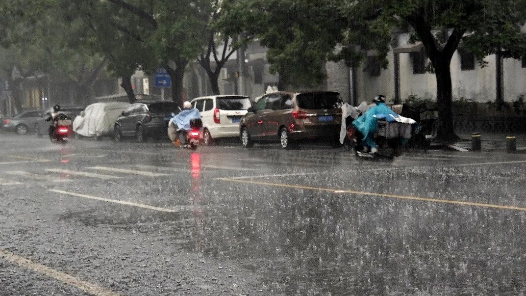
Beijing's meteorological observatory issued an orange-level rainstorm alert on Thursday afternoon at 1.30 pm, marking the first warning of its severity category since the 2026 flood season commenced. The alert prompted the Beijing flood control office to simultaneously activate a Level-II flood control emergency response, signalling heightened readiness across municipal agencies and emergency services as the city braces for a significant weather event.
The alert encompasses a substantial period of weather instability, forecasting continuous heavy rainfall beginning at 2.00 pm on Friday and persisting through to 8.00 am on Sunday. This extended duration means residents and businesses should prepare for disrupted schedules and potential infrastructure challenges over a full 42-hour window. The precipitation pattern is expected to be particularly intense in several districts positioned around Beijing's periphery: Huairou, Miyun, Pinggu, Shunyi and Fangshan will experience the brunt of the system, with these areas identified as receiving the most severe rainfall.
The magnitude of anticipated precipitation underscores the seriousness of the warning. Meteorological authorities project that certain localities will experience hourly rainfall exceeding 70 millimetres, a volume that rapidly overwhelms drainage systems and creates acute waterlogging risks. Over the three-day period, cumulative rainfall in affected areas could surpass 150 millimetres, equivalent to a substantial portion of some months' rainfall concentrated into just 72 hours. Such intensity creates compounding risks as soil saturation increases vulnerability to secondary hazards.
Geographical vulnerability forms a critical dimension of the alert's focus. Beijing's topography, characterised by mountainous and hilly terrain in several districts, creates heightened meteorological risk zones where rainfall becomes concentrated and runoff accelerates rapidly downslope. Simultaneously, low-lying urban and suburban areas face waterlogging threats as drainage infrastructure struggles with volume. These dual hazards—flash flooding in elevated areas and pooling water in depressions—require distinct precautionary approaches and pose varied risks to different populations across the city.
Public health and safety protocols have been broadly implemented through municipal guidance. Residents have been instructed to minimise non-essential outdoor activities, a precaution that reduces exposure to hazardous weather conditions and also lightens congestion on transportation networks. Continuous monitoring of official weather updates and emergency advisories has been emphasised as critical for real-time decision-making, enabling individuals and families to adjust plans as conditions evolve. Public transportation use has been promoted as preferable to private vehicles, reducing accident risks and congestion during deteriorating visibility and road conditions.
Workplace and educational institutions face operational pressures requiring flexible responses. Enterprises and government institutions have been encouraged to implement flexible work schedules or staggered commuting arrangements, allowing employees to travel during less severe weather windows or remain home when conditions peak. Schools face potential class suspensions, with guidance suggesting decisions be made based on actual unfolding conditions rather than predetermined schedules. In-person training sessions and field teaching activities are particularly vulnerable to disruption given their outdoor or semi-outdoor nature and the concentrated presence of vulnerable populations including children.
Recreational and commercial activity restrictions aim to prevent exposure to acute hazards. The public has been warned against visiting scenic locations involving mountains or water features, recognising that such areas amplify weather risks through flash flooding, rockfalls, and reduced rescue accessibility. Underground commercial facilities present distinct dangers during heavy rainfall, as water ingress can occur rapidly and escape routes may become compromised. Areas with geological hazard susceptibility—including slopes prone to landslides or unstable terrain—demand complete avoidance during the alert period.
Water safety represents perhaps the most critical concern. Official guidance explicitly warns residents against approaching rivers and drainage channels, which transform during heavy precipitation events into fast-moving torrents capable of sweeping away people and vehicles. This warning extends beyond recreational water bodies to include urban waterways and stormwater conveyances that residents might not typically regard as hazardous during dry conditions but become treacherous with rainfall intensity.
Economic and operational implications ripple across the municipal system. Outdoor construction work, maintenance activities, and infrastructure operations face mandatory suspension during the alert period. Such cessation prevents workplace accidents in hazardous conditions, protects equipment from damage, and ensures workers avoid exposure to dangerous environments. This widespread operational pause reflects the orange alert's significance within China's meteorological classification hierarchy.
China's four-tier weather warning system, descending from red (most severe) through orange, yellow, and blue (least severe), provides standardised communication across the nation. An orange alert occupies the second-highest tier, indicating conditions that pose serious threats requiring substantial precautionary measures but fall short of the catastrophic scenario represented by red alerts. This classification system enables rapid public comprehension of threat magnitude and appropriate response intensity.
For Beijing residents, the alert's timing during the early flood season suggests heightened vigilance may become necessary as warm seasons progress. Southeast Asian readers should note that China's centralised emergency response framework demonstrates rapid institutional coordination—a model that differs from more decentralised systems elsewhere in the region. The specific hazard identification and targeted restrictions reflect sophisticated meteorological forecasting integrated with geographical risk assessment, offering lessons in emergency preparedness applicable across the broader Asian region where monsoon seasons and urban flooding present persistent challenges.

